Faster Results & Lower Costs
Our Drone Surveying & Mapping services help speed up and lower the cost of land surveying and mapping services with the ability to maintain a high level of precision and accuracy. We can provide data to you or a land surveyor of your choice to augment their services to help lower costs and speed up service delivery. Our data can be used to produce a wide variety of work products including orthomosaic photos for detailed visual inspection of areas and mapping data in a variety of file formats suitable for import into GIS and/or CAD software.
Our “mapping grade” data is for your own internal informational use and based on our experience has relative horizontal measurement accuracy within 4 inches and relative vertical measurements above ground within 8 inches. This data is used for general visual reference information and cannot be used for legal or engineering purposes. It’s a good option if you just need to get the general “lay of your land.”
Our “survey grade” image data allows land surveyors to produce maps and drawings with the most accurate absolute world coordinate positioning and/or relative measurements required for legal and/or engineering purposes. Note that because we are not registered land surveyors, you will need to employ a registered land surveyor to create work products that can be verified for accuracy and certified to meet regulatory and other legal requirements in the land surveying and engineering professions by including their own data collection methods. Our survey grade imaging services help the land surveyor to complete topographic surveys for large areas in less time but they do not replace the need for a land surveyor to certify the accuracy of the end work products that they will produce for you.
or
Call (561) 253-4202
Examples of Work Products Our Image Data Can Be Used For
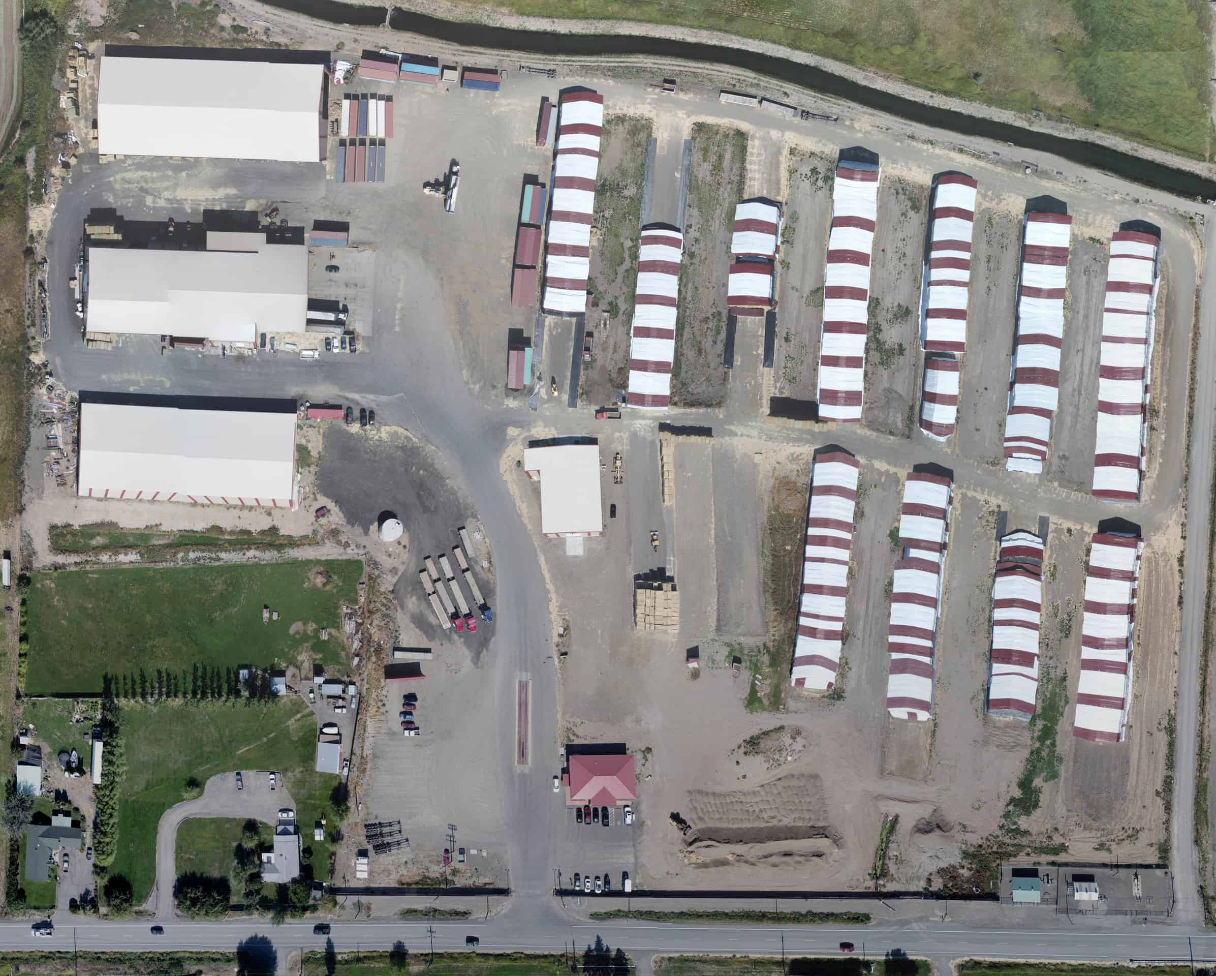
Orthomosaics
Orthomosaics provide one high-resolution image of a large site area that has been orthorectified to account for camera lens distortion and the curvature of the earth. This produces a photo (called a GeoTIFF) where horizontal distances can be measured and/or longitude and latitude coordinates can be identified on any point in the photo.

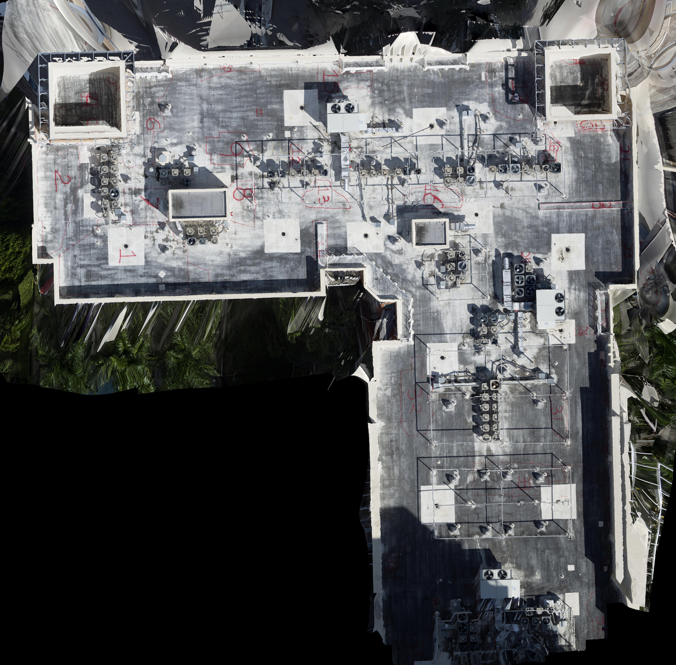
Topographic Surveys
Our image data can be used to produce a wide variety topographic survey work products including Digital Elevation Models (DEM), Digital Surface & Terrain Models (DST/DTM), and Surface Contour Maps.
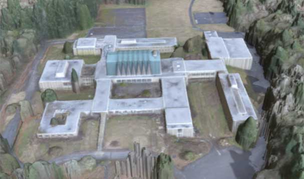
3D Models
3D Models allow full virtual visualization of a site area or structure. 3D work products include Point Clouds, 3D Mesh Models, and more. 3D Models can be used for measurement or to superimpose CAD designs onto the current project site surroundings.